
You are here
Explore the Harvard Forest Data Map
October 1, 2010
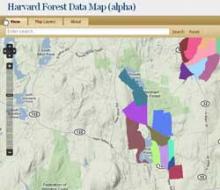
The Harvard Forest Data Map (HFDM) incorporates the technology of Geographic Information Systems (GIS) with the research conducted at specific locations. With the support of the Harvard University Provost Technology Grant and the Center for Geographic Analysis, we have combined the extensive GIS spatial records for the Harvard Forest with the actual data collected at those sites. The HFDM allows users to choose an area of interest on the map (by spatial or physical descriptions) and get a series of links (via URL's) to all of the environmental, historical, and research data electronically available for that area. View the map.
Content Tags:
