
You are here
Harvard Forest Map Collection Digitized for Public Use
February 6, 2019
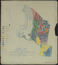
A partnership with Massachusetts Digital Commonwealth has led to the digitization of 600+ maps from the Harvard Forest Archive: local property maps, forest inventories, detailed maps of damage from the 1938 Hurricane, even winter range maps of local snowshoe hares! All the maps are free for download and use under a Creative Commons license.
- Explore the maps.
- Browse the Harvard Forest Archive online.
Content Tags:
