
You are here
Remote Sensing
Over the long history of the Harvard Forest, remote sensing data have been collected by various groups and agencies, and often stored in different formats and different locations. This portion of the Harvard Forest website is an effort to consolidate some of those resources in order to make them available to the user, without replicating existing infrastructure.
The needs of a typical user of remote sensing data can be broken down into three categories, these are:
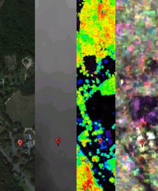
Basic access: to address the needs of basic visualization and inventory of potential remote sensing data available for the Harvard Forest region. The On-line ArcGIS Server provides an interactive visual summary of remote sensing resources available.
Intermediate access: provides some level of direct interaction with remote sensing data, either through the download of easily available data sets for the region, or by creating layers of co-registered remote sensing data. These users are encouraged to use the Quick Downloads and Customized Data Sets sections of this website.
Advanced access: to access data sources as they are located throughout the internet, advanced users will likely find the Sources of Remote Sensing Data link to be the most useful.
On-line ArcGIS Server. A simple ArcGIS server application that provides an interactive visual summary of remote sensing resources available via this website. Data available on this server can be accessed via the Quick Downloads and Customized Data Sets links as well.
Quick Downloads. A catalog of remote sensing data that can be downloaded directly to your computer.
Customized Data Sets. Using the Web Coverage Service (WCS) protocol, available data over the Harvard Forest can be windowed, resampled, and downloaded in GeoTIFF format to your hard drive. Simple IDL programs are provided to demonstrate access to his resource.
Sources of Remote Sensing Data. A catalog of links to various sources of remote sensing data.
Users interested in contributing data to this website should contact Paul Siqueira, Brian Hall or Julie Pallant
