
You are here
Weston
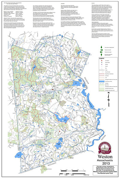 Weston is a suburb of Boston, Massachusetts, which over the past sixty years has protected over 2,000 acres of conservation land, nearly one quarter of the town. Weston has an active conservation land management program, not only maintaining walking trails for passive recreation and keeping fields open for wildlife, but also sponsoring a community farming and forestry program that engages young people with the land and produces fruits and vegetables, maple syrup, firewood, and timber.
Weston’s conservation land is managed by the Weston Conservation Commission, along with the land trust Weston Forest & Trail Association, and the non-profit community farm organization Land’s Sake.
The land is mostly woodland with a few small open fields—the remnant of a reforested New England pastoral landscape within a leafy residential suburb. This suburban ecological dynamic together with a culture of active land management makes Weston a great site for SWL’s longest-running program. Weston is close to Brandeis University, which provides faculty investigators and student research assistants through its Environmental Studies program.
SWL is working on the following projects in Weston:
- We conducted a forest inventory covering 1200 acres of town forest in 2009-2010, determining species composition and basal area for 200 5-10 acre stands. This survey is utilized by the Weston conservation commission in planning forest management activities.
- We established 100 20x20 meter forest dynamics plots and sampled the vegetation. These plots track changes in forest composition over time, comparing the development of managed and unmanaged parts of the forest.
- Every spring we sample the forest plots for deer scat piles, deriving an estimate of changes in deer population density. Weston instituted a bow hunting program in 2012.
- Every summer we visit the forest plots and select two species that deer prefer and two that they don’t, measuring the height of the ten tallest specimens of each. This provides a record of changes in deer browse pressure.
- Collaborating with the Weston Garden Club, in 2012 we established an annual Pink Lady’s slipper census along forest trails, providing another measure of changes in deer browse.
- We have established 10 deer exclosures on conservation land in Weston. The purpose of these 10x10 meter wire pens is to exclude deer so that the level of browse and its impact on vegetation can be compared to nearby control plots. Several exclosures are located near schools and are used in educational programs.
- We collaborate with Eric Olson, an ecologist at Brandeis, on his study of deer tick population in the Weston town forest, ongoing since 2013.
- Every summer we sample the forest inventory plots for White Pine Needle Disease, a complex of four species of blight fungi that has become increasingly worrisome across New England.
- We are studying four hemlock groves in Weston that are afflicted with hemlock woolly adelgid. In 2009-2010, the conservation commission treated ~500 trees in these stands with soil-injected imidacloprid. All the stands were mapped, measured, and sampled to follow their response to HWA infestation and treatment. One of the stands includes treated and untreated comparison plots. Crown assessments were conducted in 2009 and 2017 to help advise the conservation commission on follow-up treatments.
These projects engage students and citizens and provide information about the efficacy of conservation management choices. An article describing “a community forestry model linking research, management, education, and stakeholder engagement” in Weston has been published in the journal Small-scale Forestry. For more details about the projects, see our SWL research tool kit page.
