
You are here
Walden Woods
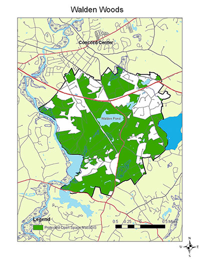 Walden Woods encompasses several thousand acres surrounding Walden Pond in Concord and Lincoln, Massachusetts. It was here that Emerson walked and Thoreau sojourned, making the pond and woods famous. Because of dry, sandy glacial outwash soils and rocky hills, from the time of English settlement in the 17th century through the height of farmland expansion in the 19th century the area around the pond remained in woodlands managed for firewood and timber, and then increasingly for conservation in the 20th century.
Today, much of the Walden Woods area is protected by Walden State Reservation, the Concord Department of Natural Resources, the Concord Land Conservation Trust, the Lincoln Conservation Commission, the Lincoln Land Conservation Trust, and the Walden Woods Project.
Conservation land owned by a range of government and non-profit owners, most of it woodland but some open land and farms, intermixed (in varying proportions) with private land, residential development, and highways, is typical of southern and central New England. The resulting social and ecological complexity makes Walden Woods an ideal model for the Sustainable Working Landscapes program. We work closely with conservation landowners to conduct ecological research and to provide information for making sometimes difficult management decisions for this much-loved, much-visited landscape.
SWL is working on the following projects in Walden Woods and neighboring conservation lands in Lincoln and Concord:
- We have established 150 20x20 meter forest dynamics plots and sampled the vegetation. These plots track changes in forest composition over time.
- We have constructed a Walden Woods Web Map that traces the landownership history of each parcel of land across 2,000 acres surrounding the pond, from 1652 to the present
- We are coring trees to reconstruct the management and disturbance history of several hundred acres of Fairhaven Woods, which was closely described by Henry Thoreau.
- Every spring we sample the forest plots for deer scat piles, deriving an estimate of changes in deer population density.
- Every summer we visit the plots and select two species that deer prefer and two that they don’t, measuring the height of the ten tallest specimens of each. This provides a record of changes in deer browse pressure.
- In 2018 we established an annual Pink Lady’s slipper census along trails in Concord and Lincoln, providing another measure of changes in deer browse.
- We have established 12 deer exclosures on conservation land in Lincoln and Concord. The purpose of these 10x10 meter wire pens is to exclude deer so that the level of browse and its impact on vegetation can be compared to nearby control plots.
- Six of the exclosures, along with control plots, follow regrowth after an inadvertent experiment at Sandy Pond in Lincoln, where a low-intensity forest fire burned several acres in the spring of 2015. Three exclosures are in the burn and three in adjacent non-burned areas.
- Every summer we sample the forest inventory plots for White Pine Needle Disease, a complex of four species of blight fungi that has become increasingly worrisome across New England.
- In Lincoln, we are studying a cathedral-like hemlock grove afflicted with hemlock woolly adelgid. In 2009, the conservation commission treated ~150 trees with soil-injected imidacloprid. This four-acre stand has been mapped, measured, and sampled, to follow its development as it responds to HWA infestation and treatment.
- The Lincoln Conservation Commission, in cooperation with Codman Community Farm, is experimenting with methods of grazing and mowing to enhance habitat for open-land species such as bobolinks. SWL is establishing vegetation plots and wildlife surveys to help document these experiments.
These projects are designed to engage students and citizens, and to provide more knowledge about the efficacy of management choices. For more details about the projects, see our SWL research tool kit page.
