
You are here
Research Tool Kit
Background | Conservation Plan | Tool Kit Elements | Join the Program
Background and Philosophy
 The conservation landscape of southern and central New England is complex. These are not large, unfragmented wilderness areas. Most of the land is wooded, in different stages of regrowth following centuries of farming and cutting for timber and fuel. Some of the land is still farmed, other parts have seen residential and commercial development. These land types lie intermixed in varying proportions along an urban to rural gradient, transcribed by streets and highways. Some beloved species of wildlife, such as kestrels and bobolinks, are in decline; others, such as beaver and white-tailed deer, are resurgent and posing new challenges. Meanwhile introduced species such as Norway maple and Hemlock woolly adelgid are expanding, bringing new ecological complications.
This landscape is also socially complex. Some of the forest and farmland is conserved by a wide range of government and non-profit organizations with varying management goals—some in fee simple, some by conservation easements. Mixed with the conserved lands are private woodlands and farmlands, potentially open for development. Also jumbled in are residential lots, inhabited by people with strong but often conflicting views about what they would like to see on the “open space” surrounding them.
The ecological dynamics of these complex landscapes are poorly understood—they are messy, changeable, and difficult to study. Some species such as white-tailed deer or red maple are not confined to one habitat but move through the landscape (including the residential parts)—not only animals but also plants, over generations. Others, such as interior-nesting forest birds, find fragmentation inhospitable. These mixed up, shifting landscapes present owners with many challenges. Should deer be managed by hunting? What, if anything, should be done about “invasives” and forest pests? If local farming is encouraged, what effect will that have on wildlife? Is “sustainable forestry” beneficial, or destructive? Such decisions must be made under the watchful eye of people who love to walk these lands and care about them passionately.
The Sustainable Working Landscapes program aims to address these challenges. Its first purpose is to gain new scientific understanding of the complex ecological dynamics of these landscapes. Its second purpose is to provide landowners with information that helps them make management decisions. Its third purpose is to engage students and local residents in ways that deepen their understanding of these places, and their attachment to them. Its overriding purpose is to encourage active stewardship of land that enhances ecological benefits, and thereby to encourage more land conservation.
Sustainable Working Landscape Conservation Plan
What questions are studied will depend on the needs of the landowners and the interests of the researchers. Each place is different and faces its own special challenges, but there are many common questions across New England. Understanding them can benefit from a common research approach carried out at many sites. The Sustainable Working Landscapes program has two model sites in Weston and in Walden Woods (Concord and Lincoln), Massachusetts. Many of the research elements are replicated at Highstead in Redding, CT and at Harvard Forest in Petersham, MA, as well as at other places around New England.
We believe a Sustainable Working Landscapes research program is an important part of any long-term regional conservation plan. The scale of the study area can vary, but it should contain enough land to broadly represent the surrounding region—one or two thousand acres is usually about right. The two essential ingredients are committed landowners and well-supported researchers. The core landowners might include some combination of a land trust, a town conservation commission, and private farmers who are interested in being part of a coherent long-term land management strategy. The research institution might be a local university or a conservation organization with a scientific arm—any place that has access to students, and that can provide long-term continuity for the work.
Research Took Kit Elements
Wildlands and Woodlands Stewardship Science
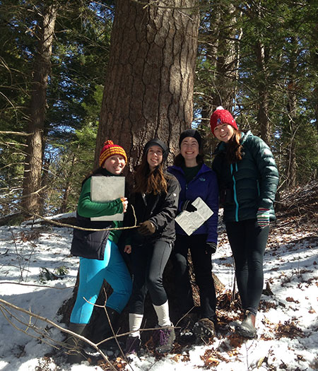
- Stewardship science uses long-term forest inventory plots spread across the study area.
- The number of plots can vary, but there should be enough to fully capture the diversity of forest types: in each of our forests of a thousand acres or more we have at least 100 plots.
- The permanent 20x20 meter plots are randomly located within the major forest types.
- Every five to ten years we return to collect data on tree species and size, as well as understory vegetation and coarse woody debris on the forest floor.
We are part of a larger network conducting such studies across New England—the methods are more fully described here: https://www.wildlandsandwoodlands.org/science-initiatives/stewardship-science. The inventory plots track long-term changes in the forest, making them increasingly valuable over time. We are particularly interested in ecological divergence between managed and unmanaged parts of the forest—so study areas that have some management activity (such as logging or prescribed burns) but also designated wild reserves are ideal. Once established, the plots also provide a handy resource for other research questions that may arise.
Forest Legacies
New England forests are strongly shaped by their past—both the history of former land use such as pastures, hay meadows, and woodlots, as well as disturbances such as chestnut blight, gypsy moth, and the Hurricane of 1938. Those who wish to understand the ecological dynamics unfolding in their woodlands, to manage them sustainably, or simply to appreciate them more fully, can benefit from uncovering something of their history.
- The primary tool for investigating forest history is the increment borer, with which a researcher can extract a core from a living tree, showing annual growth rings. These can reveal not only how old the tree is, but also the years at which its growth was retarded (for example, by defoliation by a pest) or released (for example, by the loss of surrounding trees by logging or a windstorm).
- More information on the history of a woodland can sometimes be gleaned from the soil (does it have a “plow zone” that indicates past cultivation?) or from indicator species (does it have suppressed cedar and juniper that once flourished in open pasture?).
- Archival research can help determine who once owned the land, and sometimes what use was made of it.
The Sustainable Working Landscapes program is conducting historical research on our sites in Weston and Walden Woods, and our Walden Web Map of past landowners is available for public use.
Deer Population
 The resurgent deer population is one of the most interesting and difficult conservation issues facing New England’s rural and suburban communities: not a wild species that is any longer in danger, but one that many believe is now too abundant. An important but poorly-understood ecological component of the pre-European forest, deer had all but disappeared from the region by the 1800’s, primarily because of heavy hunting. In the past century, game laws that tightly controlled hunting helped restore a high deer population (as they were designed to do), and in recent decades, as deer have moved into suburbanizing areas where hunting is difficult, local populations have often exploded. This is a public health concern because of collisions with cars and because deer are the most important host sustaining a large population of the black-legged ticks that transmit Lyme disease (although they do not harbor the disease themselves). Deer also have a powerful impact on woodland vegetation by browsing tree seedlings and many herbaceous and shrub species.
Whether or not to attempt to manage deer populations, by hunting or some other means, is one of the most vexing and controversial questions facing conservation landowners, especially in suburban areas. Many people like deer, or dislike hunting, or feel that deer are being unfairly blamed for more complex ecological problems caused by people. Scientific research alone cannot resolve these deeply subjective debates, but it can at least provide useful information on the size of deer populations, the impact of their browsing, and the effectiveness of hunting programs. It can engage more citizens and community leaders with these questions, thereby helping them to make informed decisions. If carried out at enough sites across the region, it can give scientists and managers a much fuller picture of the complex and fluid ecological dynamics of changing deer populations.
In Weston and Walden Woods we are carrying out the following projects related to deer:
- Every spring we sample the forest plots for deer scat, deriving an estimate of changes in deer population density. Deer drop pellet piles at a known rate per day, so a spring census of piles deposited over a given area since leaf fall the previous autumn gives a rough estimate of deer density. To be meaningful such data must be collected over a large number of sites, and our forest inventory plots provide just such a widespread sampling infrastructure. We carry out our census in collaboration with the MA Department of Fish and Wildlife Management, which is involved in tracking deer densities across the state by this and other methods. Over time, this censusing may provide interesting comparisons in population trends between towns with bowhunting programs, and neighboring towns without them.
- Every summer we visit the forest plots and select two species that deer prefer and two that they don’t, measuring the height of the ten tallest specimens of each. This provides a record of changes in deer browse pressure—for example, under light pressure even the species deer like may gain height from year to year; whereas under heavy pressure even the species deer don’t like may be suppressed. This simple method, devised by Tom Rawinski of the US Forest Service, can be used by citizen scientists to keep track of the impact of deer. Once again, our network of forest inventory plots makes it an easy method to apply.
- In 2012, collaborating with the Weston Garden Club, we established an annual Pink Lady’s slipper census along town forest trails, providing another measure of deer browse. We are expanding this project to conservation lands in Lincoln and Concord. Deer are fond of Lady’s slippers, people are fond of Lady’s slippers, and they are easy to count, so this is a good combination. Populations and flowering vary considerably from year to year so it will take years of data to discern meaningful trends, but the project lends itself well to citizen science and involving people who care about local forests. We believe it has wide applicability.
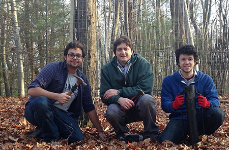
- We have established 10 deer exclosures on conservation land in Weston, and 12 in Walden Woods. The purpose of these 10x10 meter wire pens is to exclude deer so that the level of browse and its impact on vegetation can be compared to nearby control plots. They are sampled every year. Three of the exclosures are part of an experiment examining forest regrowth after a light surface fire, under browsed and un-browsed conditions. Several exclosures are located near schools and are used in educational programs. The sampling methods we use are similar to those at Harvard Forest and at Highstead in Redding, CT. We have also helped establish exclosures on watershed land of Northampton, and conservation land of Lexington, MA. We aim to keep building a network of exclosure experiments across New England.
- We collaborate with Eric Olson, an ecologist at Brandeis, on his study of deer tick population in the Weston town forest, ongoing since 2013. Olson samples ticks every summer at several sites, using methods pioneered by Thomas Mather at the University of Rhode Island. Again, there will be annual fluctuations in ticks for many reasons, but over time we hope to get some indication of whether there are correlations between changes in deer density and in tick populations.
Forest Pests and Pathogens
One of the most difficult challenges facing conservation landowners is how to respond to forest pests. Unfortunately, in the past century New England forests have experienced, and continue to face, a long line of pest outbreaks decimating beloved tree species: gypsy moth, chestnut blight, Dutch elm disease, hemlock woolly adelgid, emerald ash borer… Landowners are faced with a set of bad choices: do nothing and let nature (a new, global nature of intermixed species) take its course; attempt treatment by chemical or biological means (often expensive and uncertain of success); “salvage log” to recover some value from the timber and accelerate the transition to a new mix of species.
SWL research can put in place plots to monitor the impact of the pest, or to help guide and evaluate treatment. In Weston and in Walden Woods we are currently carrying out research on White Pine Needle Disease and Hemlock woolly adelgid.
- Every summer we sample the Weston and Walden Woods forest inventory plots for White Pine Needle Disease, a complex of four species of fungi that has become increasingly worrisome across New England. These diseases appear to thrive under warmer and wetter conditions. Research on WPND, led by the US Forest Service in Durham, NH, has been underway for several years across northern New England. SWL has added sampling in Massachusetts to this network. White pine is one of the leading ecological and economic forest species in our region, so monitoring of the disease is important for landowners, who may wish to take action. Thinning pine stands has been shown to be beneficial. In Weston, we are able to compare managed and unmanaged pine stands.
- We are studying four hemlock groves in Weston and one in Lincoln that are afflicted with Hemlock woolly adelgid. HWA is a tiny aphid-like insect from Japan that has been spreading through hemlocks on the East Coast since the 1950s. It devastated hemlock in Connecticut and is expected to do the same in Massachusetts; however, its progress has been slowed in the past decade by pressing close to the northern limit of its cold tolerance. In 2009, both Lincoln and Weston treated parts of their most-prized hemlock stands with low doses of soil-injected imidacloprid, a systemic pesticide. The treatment appears to have been effective in slowing the adelgid infestations for several years.
- In Weston, all the treated stands were mapped and the hemlocks measured and tagged to help guide treatment. One of the stands includes treated and untreated comparison plots, which have since been periodically sampled. Crown assessments are conducted periodically to help advise the conservation commission on follow-up treatments. In Lincoln, we put in place a four-acre research plot in which hemlocks and all other trees were mapped and measured, to follow the long-term course of the infestation and changes in the stand. We are also following hemlocks and other trees in an adjacent area that was not treated.
Open Land Species Monitoring
As New England has reforested in the past century, and farming methods have changed, many open-land plant and animal species have declined. The SWL is particularly interested in ways grass-based farming might be expanded, and grazing and haying methods tweaked, to provide increased habitat for these species.
- We have sponsored several conferences and workshops on grazing and conservation and are working with others to develop a network of research sites to carry out and monitor experiments in grassland management.
- We have collaborated with The Trustees of Reservations to re-sample their vegetation plots at Appleton Farm in Ipswich and are installing plots on Lincoln conservation lands being grazed by Codman Community Farm. We believe this is an area in which revived local agriculture and enhanced biodiversity can go hand in hand.
Join Our Program
The Sustainable Working Landscape program is eager to work with other conservation landowners who might be interested in putting elements of this research tool kit to work in their own communities. Although there is a limit to the field work we can do ourselves, we are available to help conceptualize similar programs and to help find other research partners. We look forward to the day when such on-going research will be a routine part of land conservation and stewardship across New England.
