
You are here
New Database & Interactive Maps for K-12 Research
Student data collected for the Harvard Forest Schoolyard Ecology program is now housed in a comprehensive online system developed by Information Manager Emery Boose with support from LTER. The new database allows classrooms and the public to explore and graph data archived from all Schoolyard field sites (more than 100 schools) since 2004. Schoolyard field projects include long-term studies of tree phenology, vernal pools, and the invasive hemlock woolly adelgid.
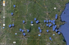
New interactive maps of Schoolyard field sites are also now available. The maps, created by Museum Assistant Greta VanScoy and Schoolyard Coordinator Pamela Snow, enable a closer look at field sites via Google Maps or Google Earth. Each site is linked to the new Schoolyard database so site data can be graphed and explored.
